Unexpected Guests – The Croatians of Jarovce (The Lost Lands #40)

Getting lost in the lost lands beyond Hungary’s borders keeps bringing me to improbable places, peoples, and history that I could never have imagined prior to developing my itinerary. I now find myself in the vicinity of the Austria-Hungary-Slovakia tripoint going to multiple villages. This has brought me to a Mitteleuropa in miniature. A microregion where the German, Hungarian, and Slavic worlds converge. The ethnic diversity that defined much of Central and Eastern Europe prior to the World Wars can still be found here. Differing ethnic groups, languages, and religions exist side by side. Despite the radical transformation this area experienced after the Austro-Hungarian Empire’s disintegration several different ethnic groups remain.

Some villages have as many as four different names. German, Hungarian, Slovakian and Croatian. The latter was a head spinner. The Croatian presence proves that this part of Europe is still ethnically mixed in ways that defy logic. Croatia’s border is 240 kilometers south of the Austria-Hungary-Slovakia tripoint. Nevertheless, Croatians have a long history in the Burgenland, the easternmost province in Austria. The area was formerly the Kingdom of Hungary’s western extremity. To make matters even more confusing, one of the region’s most Croatian villages is in Slovakia. This multicultural mix-up is worth investigating. That is why my next destination is Jarovce, also known by its Croatian name Hrvastski Jandrof. 

Cause for celebration – Burgenland Croatians in traditional dress

Interior Lives – The Other Croatia
In the western world, Croatia has a certain reputation, as do Croatians. That reputation is almost entirely based upon one of the world’s most dramatic coastlines. The shimmering Adriatic with thousands of islands dotting the seascape, the walled medieval city of Dubrovnik, and Roman Emperor Diocletian’s palace in Split are among the Croatian coast’s many treasures. Both Dubrovnik and Split are within spitting distance of the Adriatic. As are the millions who visit the country every year. Croatia’s popular image is of the sea, by the sea, and for the sea. It is thus easy to imagine that Croatians are a nation of seafaring people. If not by watercraft, then by the craft of selling their coastline’s beauty to earn a living in what is an inhospitable environment. Agriculture and Dalmatia are not synonymous. The popular image does not account for the other Croatia found further inland. Parts of Croatia are intensely pastoral. I found this out during my first visit to Croatia as I rode a train across the province of Slavonia. It looked more like an extension of Hungary than anything popularly advertised as Croatia. Slavonia was a part of the country where tourists do not tread.

I never bothered telling anyone I had been to Croatia after traveling through Slavonia. I did not want to get asked questions about the Croatian coastline and Adriatic Sea. I doubted anyone with images of Croatia dancing in their head would have believed me. All I saw from my train window were fallow fields on the verge of springing to life. Though the Slavonian landscape was extremely monotonous, I still appreciated the experience. Slavonia showed me that Croatia was much more than a spectacular shoreline and sea. Historically a large part of Croatia had a past that was based upon agriculture. These agrarian skills came in handy for Croatians who resettled in western Hungary after the Ottoman Turks’ incursion into Croatia’s interior during the early 16th century. This was the start of a long history in the area that continues right up though today.

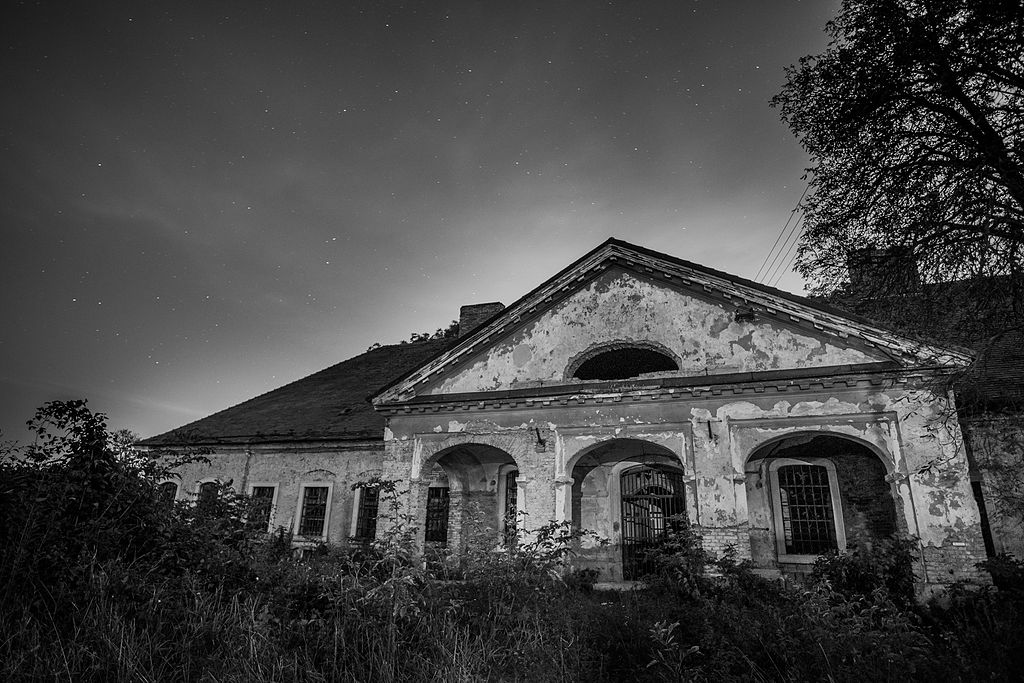
Looking up – St Nicholas Church in Jarovce (Credit: Wizzard)

Community Ties – Hrvastski Jandrof
The more successful an ethnic group is in a different empire or nation, the more likely they are to become assimilated. By that measure, what are now known as the Burgenland Croatians (easternmost province in Austria) have been wildly successful. That has made it hard to distinguish them in Austria. The best estimate is that there are 50,000 Croatians living in eastern and lower Austria. 70% of these live in Burgenland, the rest are not far away in Vienna. The culture and unique language of the Burgenland Croatians has been under threat for over a century. First by Magyarization, then fascism. These forces upended their world. In all too many cases, they were treated as second class citizens. Assimilationist tendencies continued to threaten their identity in post-World War II Austria. Despite this, there are still pockets of ethnic Croatians to be found in many villages in eastern Austria. A few outlier communities of Croatians can be found in Hungary and Slovakia. The keen observer can find them in towns that have multiple names, one of which is often Croatian.

A name can tell you a lot about a place. That is the case with Jarovce, a small village near the Danube in Slovakia that changed hands multiple times during the 20th century. For instance, the Hungarian name for Jarovce is Horvathjarfalu which means Croatian village. The name makes explicit the Croatian presence in the village. As does its Croatian derivation, Hrvastski Jandrof. That is for a very good reason. Jarovce is the only village in Slovakia where Croatians make up over 20% of the population. That number is down considerably from 80% at the turn of the 20th century. Much of that decline is due to assimilation. The two hundred plus Croatians in Jarovce might sound small, but living in a small village allows them to still make their presence felt. They would never be noticed in a city. That is what happened to the Croatians who moved to Vienna. It is hard to blame them for doing so because Vienna offers countless opportunities. Earning a living by farming in villages like Jarovce is no longer viable for most of the population.

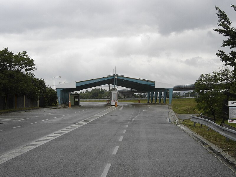
A long time coming – The road to Jarovce (Credit: Lure)

Holding Out – Present Tense
The Croatian presence in Jarovce is tenuous. How much longer they can hold on is anyone’s guess. That they made it to the present is remarkable. Croatians have always been outnumbered by other ethnic groups in the area. They always will be. Assimilation is both an opportunity and drawback. An opportunity to become part of the dominant national group. And the privileges associated with it. A drawback as it can lead to the loss of ancestral and ethnic identity. One they have managed to preserve against incredible odds.  What is Jarovce without its Croatian presence? That question may eventually have to be answered. Thankfully, not right now.

Click here for: The Places In Between – Journey To Kittsee (The Lost Lands #41)

National Insecurity – Forgotten History: Bratislava’s Bridgehead (The Lost Lands #39)

I find myself repeatedly going down the rabbit holes of history while developing my itinerary for the lost lands beyond Hungary’s borders. While researching one place, I discover another, and that leads me to still another. Then I look back and can barely remember where I started. That is not a bad thing. Getting lost can lead to new adventures. This is what happened with my choice to visit Rusovce in Slovakia. I did not realize that it was so close to the Austria-Hungary-Slovakia tripoint. This led me to research the nearby villages of Deutsch Jahrndorf (Austria), Jarovce (Slovakia) and Rajka (Hungary). As I plunged deeper into each village’s history, I forgot what brought me to Rusovce in the first place. That is until now. Rusovce, Jarovce, and the village of Cunovo were taken from Hungary at the post-World War II Paris Peace Conference and given to Czechoslovakia. None of the villages seemed to hold much value except for their location near the Danube. The reason they ended up on the other side of Hungary’s border says a lot about the fear and insecurity that was pervasive in Czechoslovakia after the war.

Bridging the divide – Danube River at Bratislava (Credit: Rios)

Buffer Zone – Territorial Ambitions
Forgetting history is often seen as a negative. The main reason why is summed up by the famous quote, “those who forget history are doomed to repeat it.” Yet sometimes forgetting history can be a sign of success rather than failure. This occurs when problems that were once acute have either been solved or faded away. One example of this phenomenon in the lost lands is especially instructive. Most people in Slovakia and Hungary are unaware that a sixty-two square kilometer piece of land on the fringes of Bratislava was given to Czechoslovakia after World War II. That land included the villages of Rusovce, Jarovce, and Cunovo. This was done to expand the Bratislava bridgehead, a military necessity at the time that is no longer needed today. Furthermore, the bridgehead is unlikely to ever be needed in the near or distant future because Slovakia and Hungary are now both members of the European Union. Border control between the two countries has been dismantled.

Despite periodic upticks in tensions between Slovakia and Hungary the chance they will have an armed conflict is virtually nil. There is also very little threat to Bratislava from the other countries that border Slovakia. Austria is peaceful and prosperous. Poland has no designs on Slovakian territory. Neither does Ukraine. The war between Ukraine and Russia has damaged Slovakia’s relations with both, but it is highly unlikely to ever have any effect on its territorial integrity. The upshot of all these developments is that the Bratislava bridgehead has faded into obscurity. That was not the case at the Paris Peace Paris Conference in 1946-47. Europe in the aftermath of World War II was a mess. Fear and insecurity were rampant. Considering the context, it is easy to understand why. Czechoslovakia had been dismembered in 1938 at the behest of Nazi Germany. The Hungarian government had joined in to get southern Slovakia back under its control. Nazi Germany took what was known as the Bratislava bridgehead for themselves. 

Displacement – Old manor house in Cunovo (Credit: Izzino25)

Strategic Imperatives – Protecting Bratislava
In military terminology, a bridgehead is a position on an enemy’s territory separated from one’s own territory by a body of water. It offers tactical and strategic advantages to the holder. They can move soldiers and supplies over the water to enhance military operations. The Bratislava bridgehead had allowed the German military to control a vital transport artery across the Danube. After World War II ended, the Czechoslovaks wanted to ensure they had an expanded bridgehead to protect Bratislava in case of another war. The city was vulnerable because of its proximity to the Hungarian border which was just across the Danube. Moving Hungary’s border further away from what was the largest city in the Slovak half of Czechoslovakia was a top priority during treaty negotiations in Paris.

The Czechoslovak delegation asked for five villages in Hungary to create a larger buffer zone between Bratislava and Hungary’s borders. Those who negotiated in support of the bridgehead felt it was vital for national security. The military ramifications of the bridgehead were obvious. There were also economic implications. Czechoslovakia’s largest port was on the Danube at Bratislava. With the bridgehead, the port would be protected. It could also be expanded. This would help drive badly needed postwar economic development. The victorious powers agreed with the Czechoslovak arguments. The result was that Czechoslovakia received three of the five villages they asked for in the negotiations.

The Hungarian villages of Oroszvar, Horvathjarfalu, and Dunascun became Rusovce, Jarovce, and Cunovo in Czechoslovakia. Most of the Hungarian inhabitants of these villages were displaced. Large numbers of Slovaks would soon move into them. The territorial adjustment was small but effective. Czechoslovakia’s border with Hungary had been stabilized. The only change to the area since then was after the Velvet Divorce occurred in 1993 as the Czech Republic and Slovakia became separate nations. Slovakia inherited the bridgehead. By then its military importance had waned. The three villages are now part of the larger Bratislava area. They are valued real estate for those who want to live in a more rural environment and commute to work in the city.

Out of the way – Abandoned border crossing at Jarovce (Credit: Bratislavcan85)

Shared Interests – Beyond The Bridgehead
Today, the Bratislava bridgehead is a historical footnote. A 2007 article in the Slovakian newspaper SME detailed how younger generations of Slovakians knew nothing about the bridgehead. The concept can be hard to grasp for anyone who did not suffer through World War II. The bridgehead was a matter of national insecurity following the war, The Czechoslovaks did not trust the Hungarians, and the feeling was mutual. Trust could only be built after decades of peaceful relations. By then, the Bratislava bridgehead was forgotten. except by the elderly and history buffs. Slovakia’s frontiers were no longer vulnerable. The Bratislava bridgehead had lost much of its reason for being. This was the best possible outcome for all involved. Economic affairs rather than military ones are now central to relations between Hungary and Slovakia. Both sides have a shared interest in moving beyond the past. Forgetting the Bratislava bridgehead is a step in the right direction.

Click here for: Unexpected Guests – The Croatians of Jarovce (The Lost Lands #40)

Crossing Invisible Lines – Border Hopping In Historic Hungary (The Lost Lands #35)

For most of the Cold War. visiting the lost lands beyond Hungary’s borders was close to impossible for Americans like me. During that time, it was not exactly easy to visit Hungary either. Less than two generations have passed since there was an iron curtain with trigger happy guards and watchtowers all along the border that separated Eastern Europe from the western world. The border was guarded by men in drab uniforms with somber faces staring out of soulless eyes. Anything that moved was fair game and shoot to kill the preferred attitude. Barbed wire was more common than grass or weeds. Border officers were brusque and inquisitive at best, threatening and brutal at worst. Everyone was under suspicion, including those who lived in the societies they were supposedly guarding.

The Iron Curtain was the greatest geopolitical fault line of the 20th century. It hung over the border between Eastern Europe and the rest of Europe from the late 1940’s to 1989. I was one of many who grew up believing the border was permanent. Nothing would or could ever change it without risking nuclear war. Europe was divided between haves and have nots, allies and enemies, nations that could never be trusted, and nations that could sometimes be trusted. There would always be capitalism versus communism, NATO versus the Warsaw Pact, and Western Europe versus the Eastern Bloc. Then in the space of several weeks, the world was reminded that nothing lasts forever, not even the Iron Curtain. 

Speaking up – City limit signage in Hungarian and German at Rajka (Credit: Marcin Szala) –

Free Movement – From One Side To The Others
As if by magic everything changed in 1989. There was no World War III and very little violence in the streets when the people revolted. The revolution came and went with such ease that it seemed almost meant to be. The memories of that time were not very memorable. Busting up the Berlin Wall was entertaining, but not for long. The executions of Nicolae and Elena Ceausescu were memorable mainly because there was nothing else to compare them to. They were a one off, or to be more precise, a twin killing. The world changed in a few months, then everyone went back to minding their own business. The liberation of Eastern Europe was a world historical event that did not feel that way. Everyone was now free to move in or out of the newly free countries.

The lost lands of Historic Hungary opened as the 1990’s began, and they have not closed since. If anything, they have become more open than ever before. This has allowed me to plan an itinerary that hopscotches across national borders with little or no barriers. In many places there is not so much as a gate. The roads are always open and some of these are my next destinations. Those will be the different roads that cross between the towns and villages on multiple sides of the Hungary, Slovakia, and Austria borders. Roads that few other than locals and highway departments know.

Roads known by names benign and sublime. These include Main road 15 (Hungary), D2 (Slovakia), and Deutsch Jahrndorf-Karlhof (Austria) which criss cross borders and go to places that just over a century ago were in Hungary. The villages I will pass through include Rusovce, Jarovce, and Cunovo which were transferred from Hungary to Czechoslovakia in the 1947 Peace Treaty With Hungary.  They also include Rajka in Hungary and Deutsch Jahrndorf in Austria. Several thousand vehicles pass nearby each day on the M15 highway traveling from Hungary and Austria to Slovakia. Very few give any thought to the villages on this multi-sided borderland, but I do.

Obsolescence – Abandoned border crossing between Slovakia and Austria at Jarovce
(Credit: Bratislavcan85)

Giving Directions – On The Right Roads
Seven years ago, while driving to the Roman ruins at Gerulata and Carnuntum. I had trouble figuring out exactly which country I was in. The intersection of Hungary, Slovakia, and Austria is close to the town of Rusovce. I kept looking for signs of the border. There were none except for signs that denoted whichever of the countries I was entering or exiting. On this occasion I was travelling with an older friend who had never visited any of the countries before. As such, I was keen on trying to make entering new countries as memorable as possible. My friend had lived through the entirety of the Cold War, so the Eastern Bloc had been terra incognita. Rather than making dramatic announcements that we had entered Slovakia or Austria, I spent much of the drive asking aloud, “Are we in Slovakia?” or betraying confusion by stating, “I think we are in Austria.” If I was confused, I can only imagine how he felt. I also wondered if we were on the right road.

On that day we crossed in out of Hungary, Austria, and Slovakia multiple times. The weirdest thing was how easy it was. Due to the Schengen Zone, which has resulted in the dismantling of border controls between all three nations, going from one to the other is the equivalent of driving from one state to another. Entering another state in America does not result in many noticeable changes. The language is the same. Roads may be a little better or worse than in the previous state, gas prices higher or lower, but that is about it. Drive from Hungary into Slovakia and the languages could not be any more different. The same goes for Hungary and Austria as well as Austria and Slovakia. Except for the road signs, it can be hard to tell between the three countries. The towns look rather similar except for the manic cleanliness and greater prosperity of Austria. Personally, I am glad that Hungarians and Slovaks do not sweep their sidewalks ten times a day. Their towns look lived in and all the better for it.

Sign of Austria – Entering Deutsch Jahrndorf (Credit: Rosso_Robot)

Strikingly Similar – A Common History
Similarities between the towns should not be that surprising. Each one was part of the Hungarian administered half (Cisleithania) of the Austro-Hungarian Empire not that long ago. The towns shared a common history until the Iron Curtain cut them off from one another.  They were ethnically mixed with Hungarians, Germans, Slovaks, Croats (!), and Jews living side by side. The European Union likes to promote multiculturalism, but it has nothing like Eastern Europe before the World Wars. That diversity is still apparent where the borders of Hungary, Austria and Slovakia converge.

Click here for: Mystifying & Miraculous – The Austria-Hungary-Slovakia Tripoint (The Lost Lands #36)

Escape Plan – The Maze In Rusovce (The Lost Lands #34)

Do you remember that scene at the end of The Shining where Danny is being chased through the hedge maze in a snowstorm by his father Jack who is trying to murder him. Jack is tracking Danny by his footsteps in the snow. It looks like Danny’s death is inevitable. He is finally able to escape the clutches of death by a careful and clever ruse. He sets a false path for his father, then retraces parts of his previous footsteps and proceeds to hide behind a snow drift. Jack is fooled into following the false path and ends up freezing to death. Meanwhile, Danny follows his own footsteps back out of the maze and into the safety of his mother’s arms. One interpretation of the film is that Danny is finding his way out from the maze of history. He can only do that by retracing his past. Paradoxically, it allows him to finally escape history. All of us are Danny, but very few of us have the cleverness and courage to retrace our past, and finally escape it.

I have begun to feel a bit like Danny in the hedge maze as I continue to develop my itinerary for the lost lands beyond Hungary’s borders. Subconsciously or subliminally, I am retracing my footsteps from a prior trip that took me to Rusovce, one of three villages (Jarovce and Cunovo are the other two) that were taken from Hungary after World War II and given to Czechoslovakia. Like Danny, I am following in my own footsteps to find a different path. Unlike Danny, I am trying to escape myself rather than someone else. The patterns I pursued seven years ago while visiting Rusovce are sure to tempt me.  Returning to the Roman ruins at Gerulata is an option I must resist. The only way to do this is by setting a new course.

Role reversal – Slovak iteration of a Hungarian street name in Rusovce (Credit; Kelovy)

Agents of Change – Creating Rusovce
My goal is to head in a different direction by searching Rusovce for signs of the village prior to it becoming part of Czechoslovakia in spring 1947. The sound of inhabitants speaking a language other than Slovak would be a clue worth following. This will not be easy because those who spoke what is now a foreign tongue in the village have mostly vanished. Ironically, most of them were not Hungarians. In the 1910 Austro-Hungarian census, two out of every three people living in the village were Germans. They did not call the village by its current Slovak iteration. Nor did they call it Oroszvar, its Hungarian name. Instead, Germans referred to it as Karlsburg. Finding a German will likely be an impossible task since they were expelled from the village in 1945. Hungarians were in no position to protect them. Slovaks would only move in after they left. The postwar period transformed the village in ways no one could have imagined just a few years earlier.

When the Germans dominated Rusovce in 1910, they outnumbered Slovaks by a factor of 30 to 1. There were only a handful of Slovaks in the village. Hungarians made up a much smaller proportion of the population, but still outnumbered Slovaks 14 to 1. The whirlwind of two World Wars changed everything. This led to the remaking of Rusovce as a Slovak dominated village. They went from being 1.6% of the population to 86.5% today. Rusovce’s population has more than doubled in size over the past century due to the influx of Slovaks. Slovakization was a planned policy. It is not hard to understand why. With the Hungarian border at Rusovce’s doorstep it was imperative to make sure loyal Slovaks lived there. Furthermore, Bratislava was to become the dominant Slovak city in Czechoslovakia. Rusovce acts as a bedroom community for Bratislava and is only thirty minutes away from Vienna. The once sleepy village finds itself growing in importance.

Three villages – A maze of possibilities

Missing Pieces – A Different History
Through World War II, Rusovce was part of Hungary, but not majority Hungarian. After 1947, some Hungarians stayed in Rusovce. Many others moved back to Hungary so they could avoid anti-Hungarian discrimination in Czechoslovakia. Meanwhile, Slovaks arrived in such numbers that the village became a town. The transformation from Karlburg and Oroszvar to Rusovce has been so thorough that imagining the village as it existed during the first half of the 20th century is close to impossible. The dominant ethnic groups of that era vanished or were marginalized. The town went from being a mostly German village in Hungary, to a feeder community for a growing city in Czechoslovakia. Now it is on the edge of Slovakia’s capital which has become one of the most prosperous cities in Eastern Europe.  

It is interesting to view Rusovce’s transformation through the prism of the town’s main attraction, the Roman ruins at Gerulata. People come from all around the area to visit the remains of the Roman fortified settlement. The ruins are austere and require quite a bit of imagination to visualize. Visiting Gerulata left me with a sense of loss, as much as it did discovery. There was a great deal of Gerulata missing. It was not hard to notice that. What I failed to notice in Rusovce was the modern history that had gone missing. There were no signs of the town’s relatively recent German identity. I saw no visible signs of Hungarians either. Then again, I did not really look for them. At least superficially, Rusovce had been so completely altered in an ethnic sense that overt traces of its multicultural past seemed to be missing. Rediscovering Karlburg and Oroszvar will mean stepping back into the maze that is the village’s history. I will be looking for how Rusovce lost its way to the present.

Lost in time – Clock on the Catholic Church in Rusovce (Credit: Wizzard)

Lost In Time – Vanished Without A Trace
In one of The Shining’s early scenes, Danny and his mother enter the hedge maze. Their visit is for fun and a bit of intellectual stimulation. There is no sense of menace, curiosity has them in its clutches. This reminds me of my initial visit to Gerulata. The history was so fascinating that I hardly gave any thought to the decline and fall of Rome that had led to the ruins. A return to Rusovce with knowledge of its 20th century history will be very different. What happened was terrible and tragic. The Germans were chased from the town. They were lucky to get out of Czechoslovakia alive. The Hungarians became second class citizens in a village that had recently been part of their own country. Unlike Danny in The Shining, I am not so sure that following in the footsteps of this calamitous past will lead to an escape. The maze of Rusovce is complex and confusing. Thousands have vanished without a trace.

Click here for: Crossing Invisible Lines – Border Hopping In Historic Hungary (The Lost Lands #35)

The Fine Print – South of the Border in Slovakia (The Lost Lands #33)

One of the more daunting aspects of modern life are the reams of documents that I am asked to sign by doctor’s offices, realtors, and insurance companies that contain a mind-numbing amount of information. These documents are supposed to inform me of my rights and responsibilities. That is only partly true. Most of them are an attempt to ensure I do not sue the providers of specific services. In common parlance this is known as “legalese.” From an early age, Americans are warned to “read the fine print.” I know very few people who have the time, nor the inclination to do so. It is implied that I am given the documents for my own good.

One thing I am sure of is that the opposite is true. The documents are so detailed and thoroughly unreadable that no one other than an attorney could possibly make sense of them. The information is rendered in such detailed legalese that it is utterly meaningless. That is why so few people read the fine print. I was never one to read the fine print either, but when it comes to works of history, I make an exception. I find that the footnotes and endnotes in history books are full of gems for those who take the time to read them. The same can be said for another type of document full of fine print, treaties. While filled with articles and clauses that make for turgid reading, treaties have enlightening details that often get overlooked. One of the most tantalizing pertains to the lost lands beyond Hungary’s borders and informs the next three stops on my itinerary.

Documenting history – 1987 passport stamp from Hungary to Czechoslovakia border crossing at Rusovce

Ceding Authority – A Detail of History
Look long enough and you just might stumble upon a greater truth. That is the case with the 35-page long Peace Treaty With Hungary negotiated and signed at the Paris Peace Conference in 1946-47. Under Article 1.4(c) the following, “Hungary shall cede to Czechoslovakia the villages of Horvathjarfalu, Oroszvar, and Dunacsun.” This is a remarkable detail because those three villages were the only ones that Hungary lost in the treaty. The total land area was just 62 square kilometers. That is 3,750 times less than the 232,466 square kilometers lost due to the Treaty of Trianon. An area equivalent to the size of Romania including Transylvania. By comparison, losing three villages to Czechoslovakia was next to nothing. I find these footnotes from history so magnetically that they will be my next destination after Paris.

Traveling back to the lost lands requires retracing my path to Paris in reverse. Fortunately, I plan to purchase a round-trip ticket for the journey between Vienna and Paris. This will take me full circle. Traveling from the Luxembourg Palace to three villages on the southern fringes of Slovakia is going to extremes, but that is quite fitting. The Treaty of Trianon went to extreme lengths in shrinking the borders of Hungary. This left many places that had once been in the heart of Hungary on the fringes of their new countries. That is what happened to Horvathjarfalu, Oroszvar, and Dunacsun in the 1947 Peace Treaty With Hungary negotiated in Paris. Before the ink was dry on the treaty, the villages had become Jarovce, Rusovce, and Cunovo in Czechoslovakia. These assumed identities would also turn out to be lasting ones. The only thing that has changed since 1947 is that the villages are now in Slovakia.

Long way home – Old milestone on former Hungarian Road #1 near Rusovce (Oroszvar) showing distance to Budapest (Credit: Kelenbp)

Border Battles – Barbarians At The Gate
Seven years ago, I was traveling with a friend to Carnuntum in Austria. It is one of the best Roman sites found anywhere along the Danube. Carnuntum was on Rome’s northern frontier. Today, it is only a few minutes by car from the borders of Hungary and Slovakia. My friend had never been to Eastern Europe, so I wanted to show him every possible aspect of the region’s history. Ancient Roman civilization is not popularly identified with Eastern Europe though the empire was spread across Hungary, Romania, and the Balkans. On the way to Carnuntum, we searched for other potential Roman sites.

The Danube was often the border between Rome and the Barbarians, as such it was heavily fortified and the scene of countless battles as the Romans were constantly having to defend their frontiers. Less than half an hour from Carnuntum we discovered Gerulata, a former Roman military camp along the Danube that had been designated as a UNESCO World Heritage Site. Gerulata is in Slovakia, only a few kilometers from the Hungarian border. I found this odd because we were south of the Danube. I had always equated the Hungary-Slovakia border between Bratislava and Esztergom as the Danube. The dividing line between the two nations for nearly all that distance is at the Danube’s midpoint. Slovakia to the north, Hungary to the south.

There are only a couple of Slovakian exceptions south of the Danube. One of which is Petrzalka, the largest borough of Bratislava that is mainly known for its residential high rise apartment blocks from the communist period. The others are the three villages mentioned in the 1947 Treaty. I did not realize that Gerulata was part of them until doing research for my itinerary. Gerulata is in the village of Rusovce and The Hungarian name for Rusovce is Oroszvar, Thus, I had unwittingly visited one of the three villages that was transferred from Hungary to Czechoslovakia. Back then, I knew nothing about the 1946-47 Paris Peace Conference or the 1947 Peace Treaty With Hungary that resulted from it. 

Roman remains – Ruins of Gerulata

Sublime Serendipity – A Fault Line
My visit to Gerulata did have me wondering why this small sliver of Slovakia was located south of the Danube. I probably thought it had something to do with the ethnic makeup of the village during the early 20th century. Perhaps Rusovce had been majority Slovak back then and the treatymakers decided it should no longer be in Hungary. I would have guessed this was due to the Treaty of Trianon like everything else that contributed to Hungary’s current borders. Now I have come to understand that Gerulata was a sublime form of serendipity. I was standing on a fault line for the lost lands. One that deserves further exploration.

Click here for: Escape Plan – The Maze In Rusovce (The Lost Lands #34)