Behind The Facade – From Mattersburg To Heinzenland (The Lost Lands #52b)

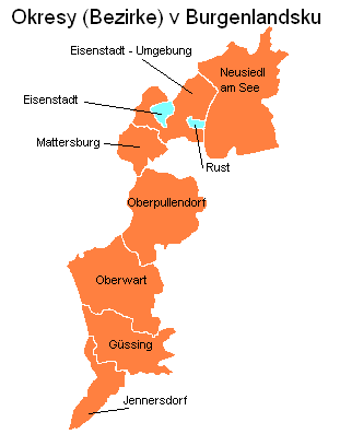
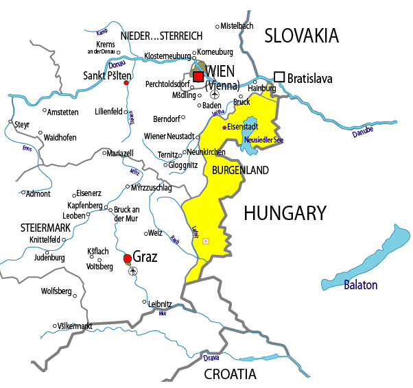
Seven years ago, I drove into the town of Mattersburg in the northern part of Burgenland. My destination was Burg Forchtenstein, a gloomy castle situated upon a slab of dolomite. Mattersburg sits 253 meters below Forchtenstein. I had not given much thought to the town beforehand. Imagining it as nothing more than a place I had to pass through on the way to the star attraction. Winding my way through the neatly kept streets and colorful houses, I felt the allure of small-town life that has been all but lost in America due to suburbanization. Mattersburg was the way I went to remember a town. People with shopping bags strode down the sidewalk, the storefronts were filled with merchandise, park benches were conveniently situated, everything was within walking distance. I was sure gelato lurked less than fifty meters from any place in the town center. What could possibly be better than that. Mattersburg struck me as the kind of place that takes pride in itself. The town was an Austrian version of Norman Rockwell.

I have my doubts about Austria with its oppressive cleanliness, neat freak neuroses, manic precision and people whose silent intensity makes me nervous. What I do not have my doubts about is that Mattersburg presents a pleasing prospect to visitors. I lost myself in a sort of nostalgic revelry for a world that I thought no longer existed and wondered if it ever really did. Mattersburg made a believer out of me. Lost in this revelry were my usual forebodings that a darker history was hidden by the happy face of Austria. I knew that conflict had happened in these small towns, and those events were still within living memory. There were still other similar ones which were not much more than a century old. The pristine image Austria now presents to the world obscures its tumultuous past. Even a provincial town like Mattersburg was not able to escape the maelstrom. In one case, they were at the center of it.

Storm warning – Lightning strikes in Mattersburg

A Bad Marriage – Powerful Versus Pugnacious
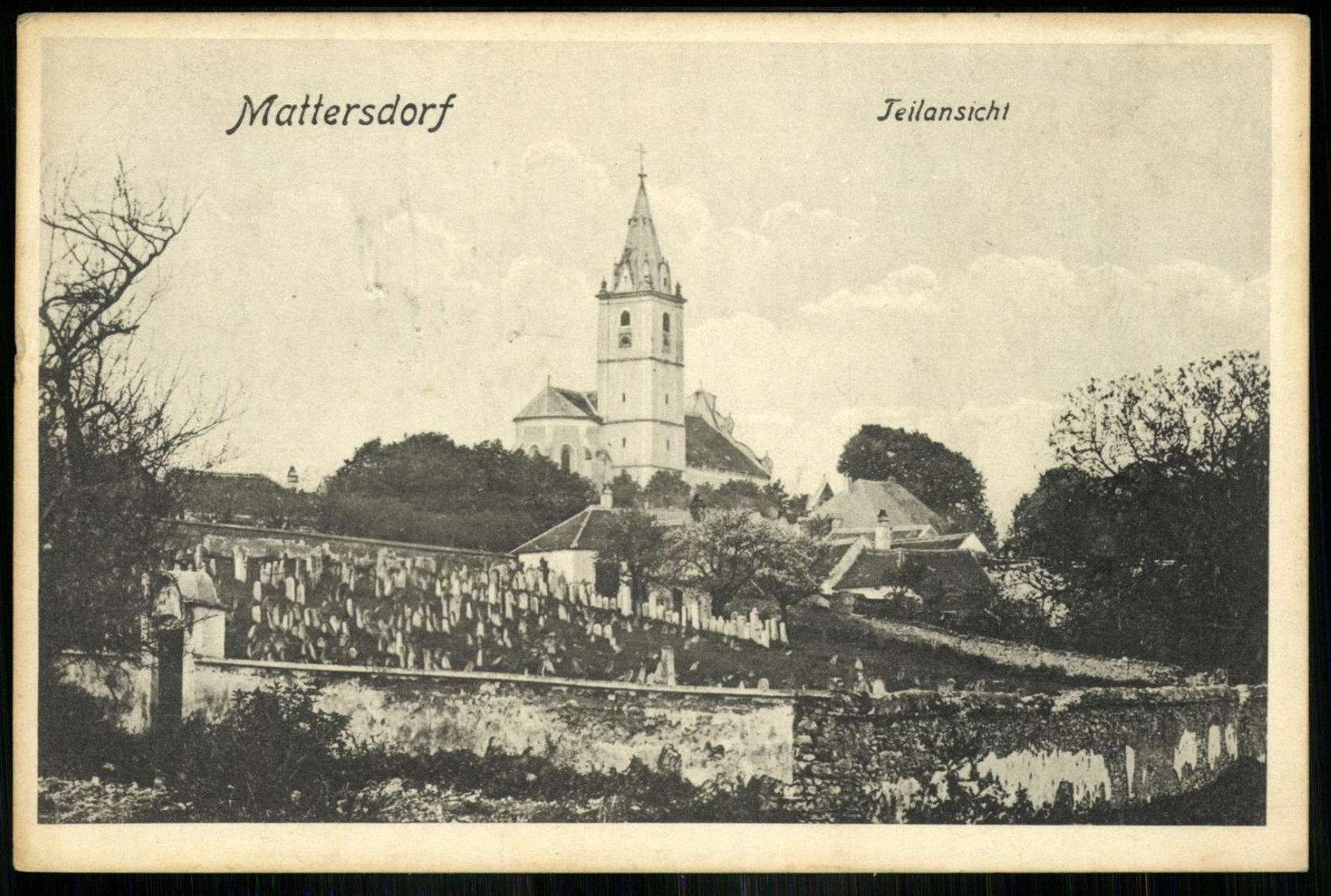
I did not learn the post-World War I history of Mattersburg (Mattersdorf until 1924/Nagymarton in Hungarian) until long after my visit. While working on my itinerary for the lost lands beyond Hungary’s borders I came across one of those obscure footnotes of history, the Republic of Heinzeland, that keep me up at night. This led me right back to Mattersburg. The town had played an outsized role in an Austrian attempt to sever West Hungary from the newly formed First Republic of Hungary. This was not all that surprising. During the Austro-Hungarian Empire, Austrian and Hungarians were bound together in the equivalent of a bad marriage where they stayed together for the kids. The marriage dissolved once the kids left home (the empire’s nine other ethnic groups) at the end of World War I. Austria and Hungary then reverted to exchanging pleasantries while subverting one another. Austria had always been the stronger sibling, while Hungary played a pugnacious role. After the war ended, both were in survival mode. Securing the future might come at the expense of a former imperial partner.

Of the two, Austrians had always been the more conniving. They had inherited this trait from centuries of Habsburg rule. The Austrians knew how to stir up unrest among different groups to benefit themselves. If this included their ethnic kin in West Hungary, they were willing to do it. There were violent movements cropping up all over the former empire after the war. Austria was a terrible mess. Famine was stalking the streets of cities, towns, and villages. Hungary, which had been the empire’s breadbasket may have had more food, but their government was weak. Revolution was in the air. Soldiers had come back from the front and were adding to the chaos. They had been militarized in the trenches. Using armed force had become a way of life. Trying to create some sense of order out of this chaos would have taxed the resources of any government. The ones in Austria and Hungary were also trying to figure out their way forward in a world where they were at the mercy of forces beyond their control.

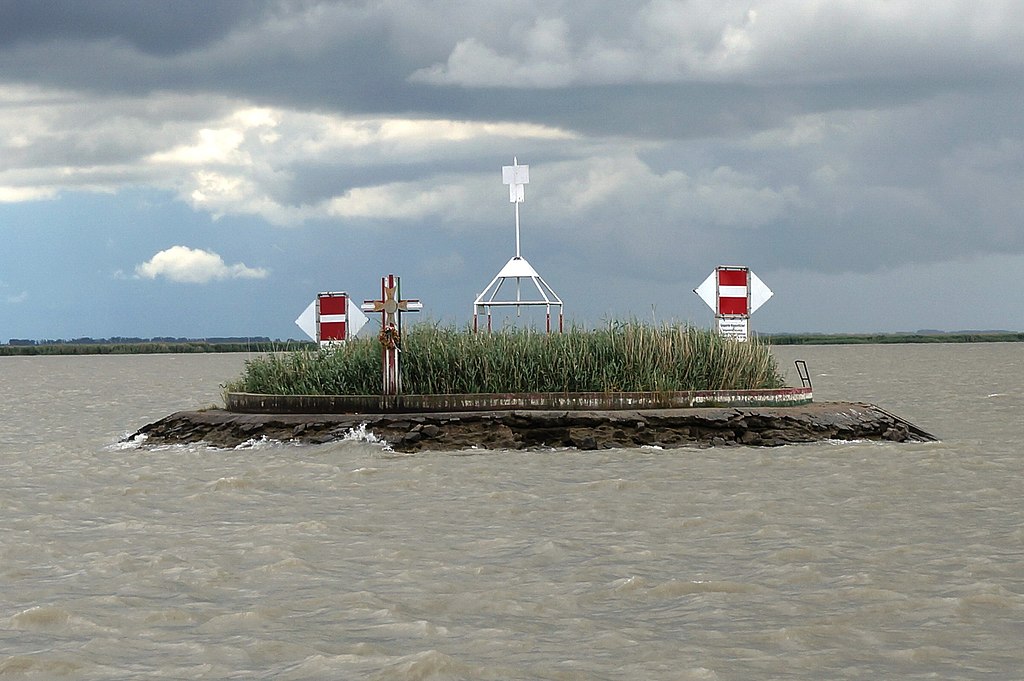
Deceptive calm – Postcard of Mattersburg

Nation Building – Disputed Territory
The Republic of German-Austria. The name sounds like an expression of the obvious. Instead, it was the initial iteration of what was to become the First Austrian Republic. It consisted of the old Austrian Empire’s Alpine and Danubian crownlands. This rump nation needed all the ethnic Germans it could get. The idea was not to create an independent Austrian state, but to instead form a union with Germany. By doing this, the core Austrian lands would safeguard their future by becoming part of a much more powerful Germany. This made sense because if left as a standalone independent state, Austria would be weak and its territory vulnerable to attack from neighboring states filled with ethnic groups it had once ruled over such as Czechoslovakia and Yugoslavia. The problem was that German-Austria’s leaders were in no position to dictate a union with Germany to the victorious powers who would decide the fate of postwar Europe.

The victors were not about to allow Austria to team up with Germany and create the kind of formidable German state they had just spent four years and the lives of millions defeating. France and Great Britain wanted Germany weakened so that it could not start another war. German-Austria was already weak. Its leaders saw an opportunity in West Hungary to boost their prospects by taking control of the territory. German-Austria could not afford to get into an outright war with Hungary. Their best bet was to stir up unrest among the ethnic German majority who made up two-thirds of the population in West Hungary. Hungarians were only the third largest ethnic group in the region. (Croatians were second). They would have trouble keeping control if there was a groundswell of popular support for the region becoming part of German-Austria. That was not going to be easy.

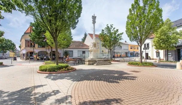
Tidy town – Mattersburg

Shadow War – A Surreptitious Setup
The First Hungarian Republic was involved in trying to keep territories on its frontiers from breaking away. To that end they sent officials from the Hungarian National Council into West Hungary to make sure this did not happen. Opposing them was the Westungarische Kanzlei (West Hungary Council) setup surreptitiously by officials in the Republic of German-Austria to lobby ethnic Germans into breaking away from Hungarian rule. Ground zero for this movement would become Mattersburg, the place that was soon to be identified with the Republic of Heinzeland.

Coming soon: A Two-Day Austrian Affair – The Hopelessness of Heizenland (Lost Lands #52c)

A Tale of Political Adventure – Finding Heinzenland (The Lost Lands #52a)

When traveling in provincial areas of Eastern Europe, I always get the sense that there is much to these places than I could possibly ever find out. This makes me want to dig deeper, but sources in English are limited. Nonetheless, I am always on the lookout for any information that might be intriguing. Many times, while reading about one thing, I come upon another. This is what happened the other day while I was researching Burgenland. I came upon a stillborn republic that preceded it. I had never heard of this republic before. I doubt many in Austria have either. That is because it lasted only two days.

Happy Days – Mattersdorf (Nagymarton) before the war

Power Vacuum – An Unprecedented Opportunity
Throughout history, ambitious, infamous, and ridiculous people have dreamed of creating their own fiefdoms. They imagine these filled with like-minded people that share the same interests. Such dreams rarely come to fruition. Very few people are willing to act on what they imagine. They lack the agency or will to try and make these dreams come true. Some that would act never get the opportunity. Circumstances that are beyond most people’s control dictate what is politically possible. During times of peace and stability there is very little support for upending the existing social order. Many have tried anyway, much to their detriment. Occasionally, an opportunity arises. Political and societal upheaval due to economic calamity, pandemics, or warfare offer unprecedented opportunities. The ambitious try to take charge and steer the situation in a specific direction that favors them and their supporters.

The headstrong believe they have finally found their moment of destiny.  This often leads to disastrous or ridiculous results. Rarely does it lead to success. History is littered with failed ideas that while they might have made sense at the time to those propagating them, in retrospect they look absurd. A few of these absurdities occurred in the lost lands beyond Hungary’s borders during the aftermath of World War I and prior to the peace treaties that transformed the region. Chaos and crisis offered opportunities. Long established institutions of law and order were crumbling. The center would not hold. Austria-Hungary had vanished. A power vacuum developed. Into it stepped political opportunists who declared the Republic of Heinzenland, a short-lived precursor to Burgenland.

Before the war – Postcard of Mattersdorf (Nagymarton) in the early 20th century

Order & Chaos – Crisis Mismanagement
It is difficult to imagine just how chaotic parts of Europe were in the final months of 1918. The traditional narrative of World War I does not do this period justice. In school, I learned that the war ended on the 11th hour of the 11th day of the 11th month. That was a pithy way of describing the armistice. The Germans capitulated and the soldiers made their way back home. The leaders of the victorious powers would soon turn to peacemaking and try to make a new world safe from war. Woodrow Wilson’s Fourteen Points would provide the direction. A closer look at history shows that there was a lot more going on in November 1918. The problem with the traditional narrative is that in many places the war may have “officially” ended, but it continued to simmer. In parts of Central and Eastern Europe it had metastasized into all kinds of smaller armed conflicts between disgruntled soldiers, paramilitary groups, communists, nationalists and monarchists. This situation had been provoked by the disintegration of the Austro-Hungarian empire. The cliché that power abhors a vacuum was never truer as political and ethnic factions vied for control of the empire’s territory. Wilson’s call for self-determination manifested itself in a call to arms across the region. The situation had turned into the geopolitical equivalent of every man for himself.

An apt description of the situation might go further and say that it was every military force and political adventurer for themselves. Each was fighting for their own interests and had political ideas to go with the guns. These ideas came in the form of republics that attempted to bring order to the chaos. The wastebin of this period is littered with regional republics that had very little chance of succeeding. That certainly did stop their supporters from trying. Several of these were existential threats to regions that had been part of the Hungarian controlled half (Transleithania) of the Austro-Hungarian Empire. These incipient republics undermined the notion that Hungary would continue to control these outlying regions. They were declaring independence and breaking away from Hungary.

From the Hungarian perspective, this had to be stopped. If not, Hungary would lose these lands and the ethnic Hungarians who lived in them would be living in states dominated by other ethnic groups. Furthermore, the breakaway republics were setting a dangerous precedent that others might soon follow. Among the newly founded states were the Republic of Prekmurje in eastern Slovenia and the Republic of Banat in southwestern Romania/northeastern Serbia. These states were small and maintaining their independence would be extremely difficult. They could dissolve just as fast as they rose. The Republic of Heinzenland offers a telling example.

Point of contention – Men on the street in Mattersdorf (Nagymarton)

Breaking Away – On The Verge
In West Hungary, ethnic Germans were two-thirds of the population in the counties of Moson, Sopron and Vas. With regions of the now vanished Austro-Hungarian Empire starting to go their separate ways, it was just a matter of time before the idea took hold in West Hungary. This was an unprecedented opportunity for the majority ethnic group to get out from under Hungarian rule and join their brethren in a German-Austria that was beginning to form. Like other ethnic groups in the empire. they had chaffed at Magyarization policies that imposed the Hungarian language on them prior to the war.

If the Germans of West Hungary acted with speed and decisiveness they could become part of a German-Austria that would better represent their interests. Self-determination was self-interest.  These Germans should probably have been in the Austrian administered half (Cisleithania) of the Austro-Hungarian Empire all along. Now was their chance to set a different course for their future. In November 1918, ideas were afloat for a breakaway republic. In the chaotic political environment, separatism began to spread like wildfire. The situation in the town of Mattersburg (Mattersdorf until 1924/Nagymarton in Hungarian) was on the verge of an explosion.

Click here for: Behind The Facade – From Mattersburg To Heinzenland (The Lost Lands #52b)

A Lesson In Creativity – Understanding Burgenland (The Lost Lands #51)

Burgenland is like the person who gets invited to dinner and the guests forget they are there. After the meal is finished someone out of politeness finally asks them a question and is perplexed by the answer. The guests mutter to themselves, “what are they doing here?” No one answers and everyone goes back to ignoring them. Burgenland is the unexpected guest who is happy to never call attention to themselves. It does not ask for attention and affirmation. Burgenland is one of those places that does not make sense and somehow still does. It is the Austrian equivalent of the middle of nowhere. And for me, nowhere is the place to go.

Ideal setting – District of Oberwart in Burgenland (Credit: Zeitblick)

Becoming Burgenland – Bordering On War
Burgenland’s creation was improbable. I find that to be one of its most attractive traits. The phrase, “you can’t make this stuff up” comes to mind.  As a province, Burgenland never existed prior to the birth of Austria. It was cobbled together from the counties of Moson, Vas, and Sopron that had been in the Kingdom of Hungary. The name was contrived and to a certain extent so was its territory, but there was a certain logic to its creation. Two-thirds of the inhabitants in the 1910 Austro-Hungarian census of the region that would become Burgenland were German speakers. They were the descendants of ethnic Germans who migrated to the area in several waves over the previous 500 years. Putting them in Austria was logical. Hungary was not happy with the creation of Burgenland. They were in no position to do much about it, but that would not stop some nationalists from trying.

Burgenland became another of the lost lands beyond Hungary’s borders. This was grudgingly accepted, but a backlash led to an uprising in West Hungary. The result would be Hungary gaining the city of Sopron and its outlying area through a plebiscite. The rest of Burgenland would remain as the eastern extremity of Austria. Burgenland would become a borderland in more ways than one. How many provinces can say that they share a border with three different countries, two of which – Slovenia and Slovakia – have a shorter existence than Burgenland. Like many borderlands, Burgenland was also a source of conflict during its birth. Two failed states arose there after World War I, the Republic of Heinzenland and Lajtabansag (Banate of Leitha). Burgenland might have been a backwater, but many of the inhabitants felt the land was worth fighting for.

Putting together the pieces – Burgenland’s Districts

Flip Sides – Going In Reverse
On a map, Burgenland looks like it was thrown together from disjointed parts grafted onto each other.  There is a symmetry to this that involves a geographical role reversal. Burgenland was the flip side of the same coin for Austria and Hungary. It was the westernmost part of the Kingdom of Hungary before it then became the easternmost extent of Austria. For the longest stretches of its history, Hungary administered the region, but Hungarians were never the majority ethnic group. In the early 20th century, ethnic Germans outnumbered Hungarians eight to one. Astonishingly, ethnic Croatians also outnumbered Hungarians by almost two to one. Hungarians either owned large-landed estates, acted as border guards or were bureaucrats. This meager Hungarian presence made Burgenland an easy grab for the treaty makers as they created Austria. While this ended up working out, it is hard not to feel that there was a make it up as you go mentality.

Burgenland has a strong north-south orientation (166 kilometers) and a weak east-west one. It is much longer than it is wide. A traveler who wants to keep within the borders will inevitably find themselves going either north or south. The slenderest portion of the province is only five kilometers in width. That narrowness has presented problems in the past. During the Cold War, trains heading either north or south at one point would cross into Hungary. The doors were sealed so no one could leave the train while it transited this Iron Curtain corridor. Today, that is no longer a problem since Austria and Hungary are both in the Schengen Zone. I know from experience that it is easy to get around Burgenland despite its strange geography. It is helpful to remember that Burgenland’s shape was the product of a peace conference. That makes it easier to understand why it looks so strange on a map. This can be of benefit to the traveler.

Gloom & room – Courtyard at Burg Lockenhaus (Credit: Monyesz)

Casting Shadows – Gloom & Room
There are very few places with such a long and unique history that a traveler can cover in a couple of days or less. Burgenland is one of them. Driving the entire province from north to south takes as little as three hours. For those who want to see more, nothing is ever far off the beaten path. A comprehensive trip can cover Burgenland’s seven districts in less time than it takes to visit three or four museums in Vienna. It is bound to be more relaxing. Burgenland may be Austria’s smallest province, but it is also the least populated. Time moves to the rhythm of rural life. This allows for visiting the most important historic places at a leisurely pace. There are a couple of can’t miss castles for very different reasons. These are Burg Forchtenstein and Burg Lockenhaus. The former is associated with the Esterhazy’s, the pro-Habsburg Hungarian noble family par excellence whose splendid palace also adorns Eisenstadt.  

Lockenhaus casts a much darker historical shadow as it is one of Elizabeth Bathory’s old haunts. Putting her name with the place is bound to get attention as the infamous Blood Countess was reputedly the worst female serial killer in history, though that is open to debate. After contemplating Bathory’s exploits, everyone is bound to need a break. Burgenland’s diverse landscapes provide that. In the north, flat and rolling farmland predominates. The further south one travels, the hillier and more forested the terrain. Forchtenstein feels positively gloomy, perched on an outcropping of dolomite. In the southern reaches of Burgenland lies the warmest area of Austria. Positively balmy compared to the country’s Alpine areas. By this point, the traveler should have a good understanding of Burgenland’s geography and an idea of its history. Few travel the length of this lost land, but those who do will never forget it. Burgenland is nothing if not memorable. If only more people knew that.

Click here for: A Tale of Political Adventure – Heinzenland (The Lost Lands #52)

Itinerary Traveler – Burgenland By Way Of Comparison (Lost Lands #50)

Austria may be repressively pristine, but it is a traveler’s dream if they can afford it. This makes Burgenland the easiest of the lost lands beyond Hungary’s borders in which to travel. There is safe and reliable public transport. For anyone with their own vehicle, the roads are in excellent condition. Accommodation is plentiful, and infrastructure throughout Burgenland is top notch. Historic sites are well done, with exhibits in multiple languages. Though the landscape is nowhere near as stunning as the alps, Burgenland’s pastoral beauty is pleasing to the eye. If this all sounds like an advert for visiting Burgenland, well that is just the way Austrians like it. The province might not be perfect, but Austrians have tried and succeeded in making the visitor experience memorable. It is impossible not to compare this with the other lost lands, which are not nearly as refined. This is part of their allure, but it does have drawbacks. 

Rising to the sky – Rainbow in Neusiedler See-Seewinkel National Park
(Credit: Leander Khil)

Tripping Out – Pressed For Time
The largest portion of the lost lands is in Romania. They are so vast that one could spend a lifetime exploring them. That sounds wonderful, but the traveler is always pressed for time. Shrinking an itinerary down to something more doable will still result in having to cover a large swath of territory on either trains or buses that often do not run on time. The alternative is driving in a country with substandard roads and aggressive drivers. That is still the preferred option for the adventurous. Transylvania, Szekelyfold (part of Transylvania), Timișoara (Temesvar) and Oradea (Nagyvarad), are the four best places to understand the lost lands. I visited each of them over a seven-year period and still did not do them justice. Taking a trip to all four in the same journey would be an exercise in exhaustion and superficiality. The lost lands in Romania require multiple trips to see the most important sites and gain a thorough understanding of their history. Unfortunately, most travelers do not have the time, patience or curiosity needed to pull this off.

Slovakia has the second largest amount of territory that Hungary lost in the Treaty of Trianon.  Slovakia’s Hungarian population lives in the southern part of the country. That makes visiting the lost lands on a single trip easier than Romania, but it still be a daunting task. Bratislava (Pozsony) and Kosice (Kassa) – Slovakia’s two biggest cities – are the ones most important to Hungarian history and understanding the Treaty of Trianon. The two cities are on opposite sides of a mountainous country. Between them there is the Spis region which has been influenced by Hungarians. It should not be missed, both for its history and spectacular beauty. To give the lost lands in Slovakia their due diligence takes at least two trips. 

Timeless scene – Vineyard and house in rural Burgenland (Credit: Michellethewise)

Balkanization – Going Remote
Serbia’s lost lands can be done in a single trip. Most of the traveler’s time will be spent in Subotica and Sombor rather than exploring a flat and mostly featureless agriculture landscape. Slovenia’s Prekmurje region is a rural outlier with a small ethnic Hungarian population. There are few notable sites, and none of these attract a great deal of attention. On the other hand, there are few more illuminating experiences than spending time in rural villages frozen between past and present. This is how most Eastern Europeans used to live and some still do. The lost lands in Ukraine are remote geographically and geopolitically. Located in the shadow of the Carpathian Mountains, few foreign visitors ever make it there.  Because Ukraine is currently defending itself against Russian aggression in the largest war in Europe since 1945, travel in the region is difficult. That is nothing new. This is one of the poorest areas in Ukraine with infrastructure to match. The Hungarian influence is notable in a few places, but nothing that would detain the traveler for more than a single trip.

Croatia is another outlier. It enjoyed more autonomy than other areas of the Kingdom of Hungary. The intertwined relationship between Croatians and Hungarians stretches back to the Middle Ages. This connection moderated much of the Hungarian rancor caused by Trianon in the other lost lands. Croatia went quietly. The parts of Croatia with Hungarian influence are not those found in popular images sold to western tourists. The Dalmatian coastline could not be further from eastern Croatia and the region of Slavonia. Working the land was as important in these areas as it was in Hungary. Baroque manor houses that went up after the Turks were expelled from the region in the early 18th century are worth the effort it takes to get there. The traveler can be forgiven for thinking they have not strayed far from Hungary. The same could be said in different forms and fashions across the lost lands.

The long view – Burgenland (Credit: Grenzlandpoetin)

Charm Offensive – There For The Taking
That brings us to Burgenland. The lost land that does not feel like it is lost at all. Burgenland is just sort of there, waiting to be noticed. It is used to being ignored in Austria, as it was in the Kingdom of Hungary. Why should it expect anything else from foreign travelers? Its fellow citizens are beating the doors down to get there. They have other things on their mind, like Vienna. One of the oddest aspects of Burgenland is how its northern part can be so close to Vienna, and it is still overlooked. If not for the composer Joseph Haydn, would anyone be able to connect a person or place with Burgenland. I seriously doubt it.

Burgenland is the very definition of a place that is neither here nor there. Do foreigners know when they are passing through the province? Do they care? The inhabitants of Burgenland are at home, but no one is knocking. They do not seem to mind being ignored. Anonymity has its virtues. Those virtues are waiting to be discovered. Burgenland could use more wine enthusiasts, birders, Haydn obsessives. history lovers and ethnographers. Burgenland is a land of fascination if you know what to look for. Its subtle delights and rural charms are there for the taking. I can hardly wait.

Click here for: A Lesson In Creativity – Understanding Burgenland (The Lost Lands #51)

Distant Memory – Taking The Waters At Lake Neusiedl (The Lost Lands #49)

Once a trip spirals out of control, there is no telling where it might lead. This is the case with my itinerary for the lost lands of Hungary. Burgenland now obsesses me for reasons that I cannot quite understand. I did not see this affection coming. Burgenland is the lost land that should not be. A place that wears its post-Trianon prosperity with honor. Like the rest of Austria, the too good to be true aesthetic disturbs me. Austria is too pristine, too Disneyesque, too much of a Teutonic Truman show. Any place where I can eat off the sidewalk is a no-go zone. Everything in Austria runs as close to clockwork as humanly possible. Perhaps that is the reason why Austrians produced art and architecture that rocked the established social order several times during the 20th century. Repression makes Austrians do strange things. That is why I planned to only make a couple of obligatory stops in Burgenland before moving further south to Slovenia. Instead, I am finding a great deal worth investigating in Burgenland. The province is a sort of Austria-lite that runs counter to the country’s popular image. Forget alpine environments and pristine mountain lakes. Burgenland is an acquired taste with subtle beauty. A fine example of this is Lake Neusiedl, (Neusiedler See)/Lake Ferto (Fert-to), the next stop on my itinerary.

Light in the distance – Lake Neusiedl on the horizon
(Credit: Peter Szuchomelli)

Lost Opportunities – Looking The Other Way
For a reason that will forever remain a mystery to me I inadvertently failed to visit Lake Neusiedl on my previous trips to Burgenland. The most likely reason is my psychological phobia involving large bodies of water. They tend to repel, rather than attract me. I was just a few kilometers from Lake Neusiedl and managed to miss it. Now the lake has become a subject of intrigue. I am scouring my memory to try and recall a fleeting glimpse of the lake. Maybe I glanced out a train or car window and noticed the silver shimmer of sunlight on water reflecting in the distance. Unfortunately, no such memory exists. The truth is that I have never seen the lake except in photographs. Nor have I stood on the lakeshore or visited the historic holiday towns that dot its perimeter. My trip through the lost lands offers the opportunity for me to correct that oversight.

The fact that I have never visited the lake baffles me. The 430 square kilometer body of water has proven elusive. Either that, or through a combination of disinterest and distraction my gaze was fixated on other less important things. When I look at a map of eastern Austria and western Hungary, I can trace the different travel routes I took through the area. On three separate occasions, I was within a few minutes by train or car of the lake and managed to miss it. Perhaps the strangest thing was that despite being a completionist who wants to see every geographic and historic point of interest possible. I did not give the lake a second thought. That is until now.

If life is something that happens when you are doing other things, then a glimpse of Lake Neusiedl should have happened while I was on the way to other places in Burgenland. While passing through the area, I was aware of the lake’s existence. That is most apparent in the crinkled pages in my copies of the Bradt Guide to Hungary and Rough Guide to Hungary. Rereading the entries for Ferto-to, the Hungarian portion of the lake, I had a recollection that I had read those same words before. If I had been looking for the lake, rather than burying my head in those guidebooks then I might have caught a glimpse. In any event, that is not what happened. Now my goal is to make up for those lost opportunities.

On the fringes – Location of Lake Neusiedl in Austria (Credit: Uwe Dedering)

Spillover Effects – A Fluid Situation
Fear of water will not hold me back from dipping my toes into Lake Neusiedl. This is not any ordinary lake. The Austrians and Hungarians who have lived close to its shores for centuries can vouch for that. The lake has disappeared and reappeared due to drought and flood. It is shallow, and broad. At my height, I will be able to stand anywhere in the lake and keep my head above the water. The average depth is just above my knees. The strong winds that come howling across its waters have made the lake a haven for windsurfers. Other parts of the shoreline are covered in reed beds which historically have been harvested for building materials. The lake also supports over three hundred bird species. None of these pastimes interest me, but visiting Lake Neusiedl does. That is because the lake is one of the most unique natural environments found on and beyond Hungary’s borders.

It is easy to look at the lost lands as terra firma. Water is a much more slippery affair. In theory, borders are supposed to be physical. The reality is that they are also liquid. Instead of stepping over the border, at Lake Neusiedl someone can swim over the border. Borders usually divide Hungary from the lost land. Lake Neusiedl unites them with Austria and the lost waters. Unlike land borders where each nation takes a side, the Austria-Hungary border at Lake Neusiedl from one side into another. The situation is fluid. Nature rules this cross border relationship more than bureaucracy or diplomacy. This forced Austria and Hungary to come together long before the iron curtain fell. A cross-border commission was established in 1956. The two nations have cooperated on management of the lake ever since then. Cooperation replaced conflict because it was in both countries’ self-interest. It still is today. 

Setting the scene – Lake Neusiedl (Credit Johannes Leitner)

Shared Interests – Calming The Waters
Lake Neusiedl can be seen as a metaphor for the relationship between Austria and Hungary. It is prone to bouts of turbulence, but shared interests make it manageable. Relations between them have been so good, for so long, that the past seems more distant than ever before.  The Iron Curtain and border control no longer exist. The lake is open and accessible to all comers. Anyone can now visit Lake Neusiedl and that includes me.

Click here for: Itinerary Traveler – Burgenland By Way Of Comparison (Lost Lands #50)

The Deep End – Lake Neusiedl: Development Denied (The Lost Lands #48)

There is always an exception to the rule. Imagine a communist government during the Iron Curtain era in Eastern Europe protecting natural resources. Examples of this are so few and far between that it is hard to believe. Communist governments had a well-deserved reputation for degrading the environment. Natural resources were to be exploited to industrialize supposedly backward societies at a breakneck pace. The environmental and human costs from the communist’s point of view were collateral damage. Destroying one world to build a reputedly better one was the idea. Eastern Europe went from underdeveloped to mis-developed. The result was grotesquely polluted cities, and altered ecosystems that would need decades to heal from the damage inflicted upon them. The communist governments were banking on Marxist theory. No wonder they ended up financially and morally bankrupt.

Despite a horrific record there were a few success stories. Predictably these did follow any five-year plans. Instead, they were the product of planned neglect. A prime example was the Bialowieza Forest on the border between Poland and the Belarusian Soviet Socialist Republic (present-day Belarus). The forest is home to the only stretch of primeval forest that once covered the European Plain. The Polish portion was protected within a National Park, while the Belarusian SSR’s was protected by state decrees. The forest was left undeveloped and in a state of nature. A similar situation occurred with the Hungarian part of Lake Neusiedl (Neusiedler See)/Ferto-to (Lake Ferto) on the Austria-Hungary border. 

State of nature – Map of Lake Neusiedl-Ferto-to and the Hansag in 1783

Turbulent Waters – No Day At The Beach
It is not a coincidence that two of the best examples of communist governments in Eastern Europe protecting natural resources occurred in borderlands. The areas along their national borders were no man’s lands where travel was either restricted or banned. Borders were militarized and under constant surveillance. This was as true with borders between nations in the Eastern Bloc, as it was with those bordering western nations. Everyone was under suspicion, more so when they crossed a border. In communist societies, all resources, human and natural, were marshalled in support of ideological goals. The ends justified the means. Nature could be politicized just like the people. This happened with the Hungarian portion of the Neusiedler See. It was the only part of the Austria-Hungary border divided by a body of water. Furthermore, parts of the border were in the water. That would make it much more difficult for the communist authorities in Hungary to police.

Extending the Iron Curtain from land to water could be an expensive task. The government had to keep people out of the water and inside Hungary. The only way to do this was by closing off all activity on Hungary’s part of the lake. Hungarians would not be birding in reed beds, windsurfing or frolicking in the shallow waters. There were not going to be any days at the beach. Taking a dip could get someone arrested or killed. The upshot of banning access for Hungarians to Lake Neusiedl was that a quarter of the lake would be left in its natural state. Being on the border saved the lake from a potentially worse fate. If it had not been on the border, Hungary’s communist government might have tried to alter the lake for agricultural or industrial usage. They would not have been the first Hungarian government with such ideas. For a long time, it was thought that nature could be bent to the human will. Hard lessons would be learned.

Watermark – Landmark with cross at the Austria-Hungary border during the Cold War
(Credit: Naturpuur)

Fluctuating Potential = A Drain On Resources
Lake Neusiedl was completely within the territory administered by the Hungarian half (Transleithania) of the Austro-Hungarian Empire prior to the Treaties of St. Germain-en-Laye and Trianon assigned 75% of the lake to Austria. While under Hungarian administration there were plans afoot to utilize the lake for agriculture. This seems rather bizarre considering that Hungary has some of the most fertile land found anywhere in Europe. The push for development in Hungary during the 19th and early 20th centuries had tamed the Danube and Tisza Rivers with flood control measures. Draining water-soaked land for farming was nothing new. Lake Neusiedl was an inviting target. The water’s average depth is 1.5 feet (46 cm), and at no point is the water deeper than 5 feet 11 inches (180 cm).

Mother nature had done the lake no favors when it dried up completely in 1866. Those with agricultural designs could see the land beneath the lake and wonder what might be done. Ten years later though, the lake was full again. That offered another idea. The water could be diverted for agriculture and the reclaimed land cultivated. Never mind that the wild fluctuations in the lake’s level were natural. Since its formation sometime between 18000 and 14000 BC, Lake Neusiedl has dried up every hundred years on average. The lake was too good of an opportunity for those with visions of development to ignore it. They could point to the Hansag, an area of swamp and marshland not far from Lake Neusiedl. A large part of it had been drained over the past few centuries.

Watching the sunset – Lake Neusiedl at Podersdorf

Transformative Nature – Protection & Preservation
A plan was formulated in the early 20th century to harness the Lake Neusiedl’s potential for agricultural purposes. The lakebed would be sectioned off by earthworks. The soil deemed most fertile would be drained and then transformed into farmland. The rest of the water would be used for aquaculture. Work was due to start in 1918. That year sounded the death knell of not only the development plan for Lake Neusiedl, but also the Austro-Hungarian Empire, as both collapsed under the weight of the lost war. The changes that came soon thereafter with the demarcation of the border between Austria and Hungary saved Lake Neusiedl from development and environmental degradation.

The Hungarian part of the lake would be similarly lucky when the communists denied access to its waters. In an irony so strange that no one could possibly have imagined it, Lake Neusiedl had been saved first by World War I, and then later by a communist government. The geopolitical chaos that plagued Hungary during much of the 20th century ended up saving the lake. That is not the way anyone had planned it.

Click here for: Distant Memory – Taking The Waters At Lake Neusiedl (The Lost Lands #49)

Split Ends – Neusiedler See’s Inflows & Outflows (The Lost Lands #47)

Borders are bureaucratic creations. Attempts to impose administrative and political control between the territories of two nations. It is said that good fences make good neighbors, the same could be said for borders. Hungary knows all too well when a border is breached by an invading force. Whether as a kingdom, part of an empire, or an independent nation-state, Hungary has historically lacked strong natural borders. This left the country prone to invasion and being overrun by more powerful foes. When Hungary’s military forces suffered devastating defeats at the Battle of Mohi by the Mongols in 1241, and the Battle of Mohacs by the Ottoman Turks in 1526, all or a large part of the country was overrun with dire consequences for the Hungarian people. Invading forces knew if they could get into the Carpathian Basin there was nothing natural to stop them.

Some of the most desperate battles during World War I occurred in the Carpathian Mountains during the winter of 1914-15 when the Tsarist Russian Army tried to fight their way through the passes so they could break out on to the Great Hungarian Plain. The Austro-Hungarian Army was able to stop them at a terrible cost. The borders drawn for Hungary after the war by the Treaty of Trianon left the country even more exposed than before. There was no longer Transylvania or the Tatra Mountains between Hungary and other nations. Yugoslavia had taken the Vojvodina which resulted in the Hungarian cities of Pecs and Szeged much closer to the border. The only strong border set by Trianon was a long stretch with Czechoslovakia divided by the Danube River. This formed a watery barrier that would be difficult for any military force to cross. While Hungary lamented its loss of territory to Czechoslovakia, this natural border was more formidable than a manmade one. That border still stands today, as does the Hungary-Austria border established by Trianon.

Open border – Road crossing between Austria and Hungary

Historic Divide – The Austria-Hungary Border
Austria and Hungary were at war with one another through the centuries on several occasions. Back then, west Hungary (present day Burgenland) was under Hungarian rule. The border between Habsburg Austria and the Kingdom of Hungary was not stout enough to keep the more powerful Austrians from using their military to enforce their rule. A less than secure border made this possible. Facts on the ground bear this out, even today. The times I have crossed the Austria-Hungary border, I have noticed there are few discernable natural features that divide the two countries. The most noticeable one is the Alpokalja (feet of the Alps) which divides far western Hungary from much of Burgenland. The terrain is mostly hilly rather than mountainous. Habsburg reach could easily be extended across this border when necessary.

Today, Austria and Hungary are landlocked nations. Strangely enough, this has not always been the case. Both once had ports on the Adriatic Sea. Austria’s was Triest. The city is now Trieste in northeastern Italy, Hungary’s was Fiume, located in the Kvarner Gulf and now the city of Rijeka in Croatia. These ports were lost after World War I as the border between Austria and Hungary shrunk to its current length of 331 kilometers (205 miles). The border was defined during a large part of its existence by the Iron Curtain which descended during the Cold War and was not raised until 1989.

The border was heavily policed with checkpoints, watchtowers, and barbed wire. Crossing it from Hungary to Austria was a life-or-death proposition for much of the Cold War. The Iron Curtain border was unique as it reversed how borders usually worked. Whereas borders are usually constructed to keep people out, in the Eastern Bloc nations the purpose of borders was to keep people in. For instance, the Iron Curtain was not really a protection from invasion by the west, as it was a way for communist countries to enforce stabilization by keeping their populations from fleeing westward. Natural borders were not immune to this policy either. That was the case with a unique section of the border between Austria and Hungary at Lake Neusiedl (Neusiedler See)/Lake Ferto (Ferto-to).

Serene and stunning – Neusiedler See (Credit: Flame99)

Shifting Sides – Parting The Waters
Any mention of waterways in Austria and Hungary usually starts with the Danube. Europe’s most famous river connects Vienna and Budapest. There is another large body of water that connects the two countries. Lake Neusiedl is not far from the Danube, but it might as well be on another planet for those not from Austria, Hungary or Slovakia. It is well known to those who live in East-Central Europe. They come to vacation on its shores each summer, cycle around the lake’s perimeter, or enjoy world-famous birding. Lake Neusiedl is also part of the lost lands beyond Hungary’s borders even though a part of it is still located in Hungary. Until the Burgenland (formerly West Hungary) became part of Austria in 1920, Lake Neusiedl was considered Hungarian territory. Today, three-quarters of the lake is in Austria.

Which part of the lake is in what country hardly matters to those who visit it. There is no longer any border control. Once on the water, the border is liquid, shifting, and scarcely visible. Even during the Cold War, Lake Neusiedl followed its own natural logic. Imposing an artificial border upon it was an attempt to bend nature to geopolitics. That might work well in theory, but reality is a different matter. Marking a border in a lake is not nearly as easy as on land. Unlike the Danube, which clearly divides one side from the other along the Hungary-Slovakia border, Lake Neusiedl does not neatly adhere to neat dividing lines. Buoys rather than survey markers are the usual method for marking a watery border.

Laid out – Neusiedler See from the air (Credit: Bjoertvedt)

Floating Away – Lost Waters
National borders do not mean much to the recreationists who come to swim, windsurf, and bird on Lake Neusiedl. They are just glad to have the lake at their disposal.  Weather permitting, the water is more docile and less dangerous than the Danube. Aerial views portray the lake as innocuous and placid. A sheet of glass laid across a flat landscape. I am ready to see the lake for myself at ground level and learn for the first time about the lost waters beyond Hungary’s borders.

Click here for: The Deep End – Lake Neusiedl: Development Denied (The Lost Lands #48)

I Could Do This Forever – Burgenland: Canvas For Curiosity (The Lost Lands #42)

I could do this forever. From the armchair or preferably on the road. At some point while developing my itinerary for the lost lands beyond Hungary’s borders, I became entranced by the idea of spending weeks, months, years, going from one place to the next and finding anything of interest related to the multi-ethnic history of Burgenland. The idea of doing this has brought me to a point of complete intoxication. All I need is curiosity and a map. There are an infinite number of places, people, events, and topics waiting to be explored. A multiplicity of details worthy of investigation in the pursuit of greater truths past and present. Burgenland is first and foremost on my mind at this moment. That is bound to change whenever I step across the next border. The languages and cultures may shift, but my focus remains the same. To experience and learn everything possible while on this ever-expanding journey.

While the history I am pursuing is very old, it is all new to me. I have no prior association with the lost lands other than the few months I have spent in them over the past twelve years. And yet I feel a deeply personal connection with these regions. An intuition that makes my curiosity come alive. The only way I can explain this urgent obsession is to say that it feels like the first time you fall in love. It is unlike anything you have ever experienced before or ever will again. You cannot imagine what it was like before falling in love, and you cannot imagine what it would be like to fall out of that love. You are smitten. Only later do you realize that the object of affection is something you cannot live without. This is followed by the perpetual fear that one day you could lose it all. And that day you will lose it all.

Golden path – Birch trees at a park in Burgenland

Visiting Rights – A Canvas For Curiosity
The lost lands are a vast canvas where my curiosity is set free. While maps make the lost lands look finite, in the mental makeup of those who long to have them back, they go on forever. Officially, they are all the lands Hungary lost due to the Treaties of Trianon and St. Germain-en-Laye. Another, way of defining them is that they are all the lands surrounding the borders of present-day Hungary, and then some. In certain places those lands expand, such as from the Crisana to Transylvania in Romania or from the Danube in southern Slovakia to the Polish border. In the Burgenland, they are a narrow strip of land stretching from the edge of Bratislava all the way down to the Croatian border. Not unlike a defile that empires, nations, and peoples have fallen into. They have spent over a century trying to pull themselves back out of that defile. Try as they might, the force of geopolitical gravity pulls them back down.

Everyone has their limit, but the lost lands do not. Their spiritual existence is much larger and stronger than their physical one. Imagine living in a country that is besieged on all sides by its own past. They get to see their ex being repeatedly ravished by someone else. The European Union has given them visiting rights, but even that has prolonged the suffering. The relationship between past and present never made a clean break. Rather than a fresh start, there is a festering wound. One that no amount of fury, resolve or romanticism will ever cure. Time does not heal all wounds. In the lost lands it has hardened them, except in a couple of unique cases. The most noticeable of these is the Burgenland.

On the border – Map showing the location of Burgenland

The Happy Face – Well Above Average
Burgenland is the closest thing to a happy face that anyone could put on Trianon. All the boxes have been checked by Austria. Minority rights, check. Prosperity, check.  Assimilation and allowance for differences, check. If the ethnic minorities they inherited cannot be Austrians, at least they will be good Europeans. The situation is as good as it will get for ethnic Hungarians and Croatians. The Austrian government implicitly asks nothing more than that they abide by the law, work hard, and enjoy the benefits that the creation of wealth bequeaths to all the citizens of Austria. Why make trouble, when there is none. Go about your business and everything will work out for the best. I doubt many ethnic Hungarians or Croatians in the Burgenland care to dredge up the ghosts of Trianon. Where would they go with historical grievances except back across the Hungarian border. That is a chance few would care to take. This is the paradox of being part of the ethnic minority abandoned by force of a treaty. The country which adopted them was better than the one they were meant to call their own. .

The Austrians made a beautiful world out of the Burgenland. It is also different in many respects from the rest of the country. Burgenland comes with wine rather than beer, castles and palaces that look like they were built for tourists rather than wars, Hungarians and Croatians who speak fluent German and do not mind doing so. Burgenland ranks last in GDP per person in Austria, and the standard of living is well above average. The mountains are low, the forests are tame, the ground fertile. This is a part of Austria that defies its popular image. One where foreigners are few, and the wanderer is left to their own devices. A lost land that no one is looking to recover. These paradoxes and contradictions are sources of exhilaration that inform my latest obsession. I long to make a separate peace with the Burgenland.

The unknown Austria – Water well and thatched structure in Burgenland (Credit: Corradox)

The Outlier – A Breed Apart
I never cared for Austria before the Burgenland. It was a nation that adhered to the straight and narrow. Stiff, stodgy, and snobbish. The finer things in life honed to their sharpest image and then ground down to extreme dullness. Burgenland is a breed apart. Something about it does not feel completely Austrian to me. I suspect it has something to do with the lost lands. A legacy it wears so lightly that it barely ever gets noticed. It is that legacy which is luring me onward to a place called Parndorf.

Click here for: Kuruzzenschanze – Tracing A Path To Parndorf (The Lost Lands #43)